Welcome to the Ad-free Guide to the Perthshire Highlands


Days Out in Perthshire and Beyond
 

Occasionally I have such a wonderful time that I am inspired to put pen to paper or, more correctly, apply digits to keyboard to record for my personal amusement and memories the joyous time I have had. Good things are for sharing and I hope that you too will be amused and, perhaps, be inspired to record your own explorations.

| Bidean nam Bian
| The Aonach Eagach
| Cow Poo, Slime and the Bog of Eternal Snot (Beinn Heasgarnich)
| The Magic of a Label (Ben Chonzie)
| The Falls of Lora
| Loch an Daimh (Stuchd an Lochain)
| An Ode to the A83
| The Unprepared (Buachaille Etive Mor)


Bidean nam Bian - 15th July 2019


A name that has haunted me for many years. My nemesis. The only hill that has ever defeated me. So here I am, thirty four years later, back at Three Sisters poised to slay this monster. As such, I wanted this piece to be about the mountain, the challenges, the epic struggle for survival, the triumph of an indomitable spirit. Alas, there is very little to record in this regard. It was just another walk in a glorious location with stunning views. This piece is actually about the people with whom I interacted through the day.

Alongside the road, a lone piper, kilted and magnificent, was haunting the glen with the sound of Strathspeys, reels and laments, liberally punctuated by renditions of ‘Scotland the Brave’. Alas his pipes were somewhat waterlogged. Those top notes that should have been so clear and resonant struggled forth in a turbulent gurgle. Indeed one had the suspicion that a family of frogs had taken up residence in those damper areas, such was the coarseness of the croak. The music would stop with the sound of a feline exhaling its last, and then, before being allowed to RIP, finding itself being re-inflated and resuscitated in a new attempt to entertain the passers-by. Admittedly, the performance certainly improved with time. In fact, now I think about it, the rate of improvement had a direct correlation to the ever increasing distance between ourselves. I can safely say that the playing eventually became an outstanding virtuoso performance. It was such a shame that I could no longer hear.

There were people some way ahead of me on the path. I had little reason to concern myself with them. That is until they decided to stop for a break by a welcoming and delightful pool in the burn. By the time I arrived the father, for it was clearly a family of four, was naked and sat on a rock having been refreshed by a plunge into said pool. I said ‘hello’, made some suitably innocuous comment and passed on my way, ruefully pondering on why it is always the old man who is naked and never the attractive 20-something year old daughter. The path did a zigzag above the pool and when I next glanced down, I noted that the daughter had also stripped off and was plunging and refreshing herself in the crystal clear waters of the Allt Coire nan Lochan. One’s gentlemanly instinct is to avert one’s gaze at these moments. But as other people were coming up the path and the lass was completely unperturbed by this, one ceased averting one’s gaze and enjoyed the moment. She was, after all, shapely and ‘beautiful in form’.

A short while later, during a stop for ravitaillement, the family caught up with me. This was at a bifurcation in the path. They too stopped and mother called me over, enquiring if I was familiar with the area. Her English was very limited. I discovered that they were German, from the city of Dresden, and they were impressed that I had been there. It is evidently less popular with tourists than the cities of former West Germany: München, for example. Her English was not good, she explained, as in the former East Germany, all pupils were taught Russian as their second language. Their itinerary for today was to do Bidean and then to descend through the Hidden Valley. Were they going the right way, given that she was equipped with nothing more than a rudimentary diagram of the outing? Ultimately they were my companions for the rest of the day. At times I would go ahead and at other times they would pass by. Father and son were carrying the rucksacks allowing mother and daughter to travel lightly. They were clearly happy together and harmoniously enjoying the amazing panoramas – the smiles, the glint in the eyes, the expansive gesticulations all had a language of their own. We tried to converse more, but my German is very rusty and their English sparse, so it was very difficult. Whilst diverse languages are fascinating, they are so divisive and frustrating.

Another companion of the day was an IT bod from Bristol, contracting in Edinburgh, and taking a five-week break to do a grand tour of the Highlands and Islands by public transport.

As for the ubiquitous Asians at the car park (for this appears to be the limit of their explorative desires), I had fully intended to cut them some slack regarding their self-centred photographic habits. Alas, I just cannot bring myself to do so. For there, on my return, amongst the crowds and laying in the grass, alongside the car park on the A82, was a lady of far-eastern, possibly Japanese, extraction. The pose, for indeed she was posing for photographers, was all seductive-like. Her head was propped up by an elbow and a knee was bent in a coquettish and rakish manner. Quite extraordinary! I just hope that, later on that evening, somebody had the wisdom to check her crevices for ticks; Lyme Disease is not great. I wanted to write ‘crevasses’ for comedic effect but that would be unfair. She was not obese, but I would estimate that she probably was old enough to have grown out of such behaviour, to know better.

However, let us return to the Hidden Valley, known too as the Lost Valley in some guides. Having sampled its delights from both directions, I hope that you will not find me too presumptuous in recommending that it is best approached by the route of ascent. A tortuous path wends its way up between trees, jumbled rocks and alongside the falls and pools of the burn. There is no suggestion of the delights to come. The path eventually summits a brae and starts to descend and there, suddenly, is this wide, open, flat-bottomed valley, completely hidden from the outside world. It is a ‘wow’ moment that is lacking when descending from the bealach. And so, dear Bidean, you have been tamed, feared no longer. My excursions on your flanks were most enjoyable.

Menu


The Aonach Eagach - 26th June 2019


The legendary 'notched ridge'. The finest, narrowest ridge in mainland Britain. Exposed. Epic proportions. No escape route. Once you have started you must finish. Good grief! It sounds almost as terrifying as an Ikea store! With such write-ups and a reputation to live up to I had long put off tackling this monster route. Was I up to the challenge? But then having done it, would life be worth living? My mountaineering from this point would all be downhill – metaphorically speaking. It was a risk I decided to take. After all, it is but a little over 50 miles from home and had I been overcome with the urge to throw myself into Loch Atriochtan in a final moment of bliss, satisfaction and fulfilment, well, there are worse endings to contemplate! That's if the expedition allowed me thus far. One guide casually mentions the Clachaig Gully, where there are frequent rock falls and which has been the scene of many fatalities over the years. And that's describing the descent from this colossus, after the rigours of the main attraction have been subdued. Och dearie me! What am I doing?

All the guides advise doing the ridge from east to west, starting from the Three Sisters car park on the A82. I duly obliged. It is not a difficult location to find. It is signposted as a viewpoint, and the attraction is obvious. The views are quite stunning as one contemplates Bidean nam Bian opposite, its eponymous daughters and down Glencoe towards Ballachulish. Consequently, said parking area is always busy and not infrequently full. Nevertheless the average viewer rarely tarries long and is soon on his or her way. Now, I do know that it is naughty to stereotype people, but sometimes it is hard not to. On this particular morning there were many tourists of various Asian backgrounds and a collection of middle-aged white Europeans – predominantly Dutch. The former were totally uninterested in the view as they stared at mobile e.devices, waved them around on the end of sticks or had themselves photographed with cheesy grins. I wonder if 'viewpoint' in Asian translates as 'photo booth with mildly interesting background'? The latter would disembark, light up a cigarette and wander around, admittedly admiring the view, but puffing smoke and generally befouling the atmosphere before grinding the stub into the tarmac underfoot and driving off.

I headed back up the road for a few hundred metres, found the path and was soon gaining height. The path is well-made and easy to follow. The vehicles on the A82 below were beginning to resemble scale models when a grating sound wafted up on the hot summer air. It was the sort of sound that has one sucking air in through ones teeth and thinking 'that didn't sound good'. It wasn't good and was swiftly followed by the blaring of horns. An incident had apparently occurred between a west-bound bus and an east-bound caravan. Both eventually found space to stop where they would cause marginally less disruption and a tiny wee human from this tiny wee bus could be seen walking back towards the caravan. It is illegal to travel in a caravan and there is a good reason why. They are not built with the structural integrity to withstand a collision. I remember the aftermath of a serious incident on the A38 in Devon, many years ago. The caravan had literally collapsed like a prop in a Buster Keaton movie. Clothing and personal effects were strewn along the dual carriageway, giving new meaning to the idea of skid marks on one's underwear! Clearly today's event was not of that magnitude; I have no idea what happened and how much damage occurred. I just imagine the bus continuing on its way with minor bumps and scrapes and the caravan owners having had their holiday terminated in an instant. I hope not.

The walk to the top of the first summit of the day, Am Bodach, continued without incident. An RAF Tornado flew along the glen, far below. That always seems weird to me – looking down on a flying aircraft.

Now the fun begins. According to some guides, getting off Am Bodach is the hardest part of the day. McNeish talks of a 15 metre slab of polished rock to descend, albeit with handholds. Maybe I missed it. Although this step is tricky and gives you something to think about, I would describe it more as interesting rather than difficult. I was somewhat buoyed by this. As I gazed at the route ahead, it didn't seem anywhere as narrow or precipitous as I had expected. In fact I was reminded very much of the Tarmachan ridge in Breadalbane – on steroids. This was clearly going to be longer and more intense but it had the similar qualities: an airy walk on a grassy ridge with some ups and downs. In fact, now that I think of it, the Tarmachan ridge would make a great preparatory walk for anyone contemplating the Aonach Eagach. It is not difficult but will give a flavour of what to expect. Or just do it anyway and have a beer at the Capercaillie in Killin afterwards! Any excuse... The ascent to Meall Dearg presents few difficulties after this. And then it's on to the Crazy Pinnacles. There are many more of them than initially meets the eye. Route finding is easy enough. You follow the well-trod path where it exists and, where each pinnacle rears up before you, follow the fingernail marks where previous unfortunates have desperately clawed at the rock before plummeting to an ignominious demise! The more prosaic explanation is that they are crampon marks but why allow a lack of imagination to deny such drama? I got crag-fast only the once. My leg was clearly too short. But there is always a way. I was glad when I completed the final pinnacle – my poor knees were starting to ache. Scrambling seems to put more pressure on these joints than the usual walking that I do; undoubtedly something to do with frequently having the knees up under the chin. It's then a straightforward jaunt up to the third summit of the day, Stob Coire Leith. The path to the fourth summit, Sgor nam Fiannaidh is no more difficult.

Then there is the final conundrum – how does one get off this blessed thing? Go back the way you came? The obvious benefit is that you end back at your internally combusted steed. But how are the energy levels? McNeish says to head due south straight down the scree slopes. Others say 'whoa, hold your horses, that's difficult'. There is unanimity about avoiding totentanz in the Clachaig Gully. The general consensus is to veer north, pick up the path that leads to the Pap of Glencoe and head down towards the village of the same name. Great, but this sadly leaves one some 5 miles away from those three sisters and almost at sea level. In such a situation the unanimous advice is to have a pint at the Clachaig Inn. 'Oh, all right then. If you insist!' I could always try raising the opposable digit at propitious moments. I did both, but the latter worked only upon reaching the A82, which meant that I had had my pint by then.

A Glasgow black cab screeched to a halt and I very gratefully hurried towards it. The only seat visible was in the front adjacent to the driver, what in normal vehicles would be called the passenger seat. So I naturally made to open its door. I was met with an unintelligible Glaswegian growl, bellowed through the unopened window. 'Och naw wheesht see you jimmy och aye the noo braw heid wean!' A rough translation might be 'I say, would you mind awfully using the rear door?' So I went around the other side and a similar tirade followed. Back to the rearside nearside and I just plonked myself down amongst the cargo. This seemed to be the right thing to do and he broke into friendly banter. I have no idea what he said. I assumed it was friendly. The most important piece of information that needed conveying was my drop-off point and we managed that. I thanked him profusely, wished him a safe onward journey and disembarked. The Asians were still there waving selfy sticks. The Europeans were gathered around my car relaxing in a tobacco haze and I was back where I started: hot (24 degrees hot), tired and satisfied. And now I am wondering which of us is crazy, as crazy as those pinnacles?

As a postscript, if I do it again, solo, I would consider leaving a bike at Three Sisters. It would need to be made very secure – not that I am stereotyping Glaswegians any more than my very good 'wegie friend Evelyn does. I would then drive to the far end and do the ridge west to east. The ride back would be entirely downhill and could be an exhilarating end to the day. I wonder why no one else has suggested this? Or would that be like doing the Ikea store backwards? Enraged supervisors and middle managers demanding to know what the hell I think I am doing? Am I crazy? Am I trying to kill someone? Or tackling roundabouts in an anti-clockwise fashion. By many accounts, it seems that this ridge gets quite congested at times – queues and traffic jams caused by the crag-fast, the scared and the overly equipped. Maybe the one accord is a conspiracy to make us comply with the rules of the ridge police. None of that today. There was a bloke ahead of me whom I never quite managed to catch and one in retrospect who never quite caught me. That was it. As I like it!

Menu


Cow Poo, Slime and the Bog of Eternal Snot - 27th October 2017

There are some mountains that are just begging to be climbed. They look inviting, have interesting names and fine reputations as classics. Beinn Heasgarnich is not one of these. The name flows pleasingly enough, but even the walker’s guides fail to arouse anticipation and get the palate salivating. Large featureless plateau…difficulty in navigating…moated by peat bogs…arduous day out. All absolutely true! Right from the moment I left the hydro track it was challenging. Slippery, wet, holes full of water everywhere, great globules of green slime of the kind so beloved of children’s slapstick TV shows. The large featureless plateau, once attained, was a joy to behold and a blessed relief. It was dry and solid under-foot and finally it was possible to just walk properly instead of tussock hopping and pulling every missed footstep out of the black depths of squelch. Yes, there was an incredibly strong crosswind and that made it arduous to walk in a straight line. But who cared. I was on terra firma and with some very rewarding views! The phrase ‘crabbing sideways’ came to mind. This from an anecdote about a pilot landing an aeroplane that had run out of fuel. In order to avoid overshooting the runway he had to deploy the many tricks of his trade and coming in sideways seemed, in this instance, to do the trick. The mind wanders…

Sadly, in order to attain the next summit, one had to descend into the Bog of Eternal Snot. It seemed unavoidable. Halfway up the other side, I sort of lost the will to live. The summit had clouded over and the slime seemed interminable. I had harboured ambitions of tacking Ben Challum onto the trip but, for various reasons, I chickened out. Firstly, I couldn’t see it. Second, It was just off the edge of my map (OS LR51) and third, I’d just had enough. So I headed off along Sron nan Eun and shortly after, all low cloud dissipated. That’s mountains for you. In order to ‘do’ Ben Challum, which I have to say is a very shapely thing, I will either have to cycle, once again, the glen track covered in cows and dung or else take the tourist route from Strath Fillan. That seems like an awfully long way round. Actually it is. Glen Lochay isn’t far from home but, stood on Creag Mhor, I was actually only about three miles from that great horseshoe on the West Highland railway line.

The final insult of the day was a whole load of slimy crags that were not marked on the OS map. It’s one of those things, but when in the mountains there is always a beaten track where the route is most obvious. In this case Sron nan Eun is a broad ridge but when the ridge ends in the long grass the path disappears. I guess it becomes a case of everyone doing what is right in his own eyes. Eventually I found myself staring into space from the top of some non-existent crags. I ended up retracing some steps, clambering down a bit here, going along a bit there… I suppose that had I taken Cameron’s advice and done the pair the other way round, this might have been obvious but the weather forecast was better for the morning and I didn’t want to be lost on Beinn Heasgarnich in the afternoon. Or tackling the peat snot at the end of the day. So if anyone wishes to visit and take this pair on for themselves, please feel free. You will be very welcome. But you will need to find a different native guide!

Menu


The Magic of a Label - 8th July 2017

Munro-bagging has become something of an obsession. Everyone with a pair of boots is in on the act. Must tick another box! I am not immune to this fad. After all, it is a hugely enjoyable past-time. Hauling my increasingly unwilling body to summits over 3000 feet above sea level is hard work. I often question my own sanity. But the rewards are great; wildlife, solitude, peace, far-reaching views, time to meditate on life and everything, and a feeling of achievement, to name a few. As for the ‘bagging’ part of it, I see that as a means to an end. There are 282 Munro’s dotted all over the Highlands and that makes 282 reasons to visit places that might otherwise not be on the agenda. To conquer the full set is a notable achievement of which to be proud. But when the ‘Munro’ itself becomes the sole objective, are we not missing something? Is not the purpose in donning a pair of boots to go and enjoy the great outdoors for what it is? Dare we not bother, or speak, of conquering summits less worthy? We really are slaves to the marketing men. What about those spectacular lumps that do not have ‘Munro’ status? Stac Pollaidh and Suilven come to mind. Are they to be missed just because they are not in the right list?

Take last week as an example. Ben Chonzie (hoan or honzie) is just one grassy lump amongst many, in a vast area of pseudo wilderness south of Loch Tay. The whole area is quite glorious and bristling with wildlife. I have enjoyed many days in this area just walking, watching, and enjoying. I started from Ardtalnaig. I crested the ridge that is the Shee of Ardtalnaig, bagged the ‘Graham’ on the end and descended into Glen Almond. I followed the stream for a while before taking a track that led me onto the upper slopes of Ben Chonzie. I had lunch at the summit, retraced my steps into the glen and headed up to Creagan na Beinne, a mere ‘Corbett’ at 2910 feet. Heading due north, my route took me past the Falls of Acharn (with its hermit caves) and into Kenmore. I saw not a human soul all day – I saw sheep, some red kites, a ring ouzel, a family of weasels playing rough and tumble on the track ahead of me, curlews, skylarks, stonechats - all sorts. People? No! I had the place to myself. That was until my attainment of the summit ridge of the ‘Munro’. It was heaving with people, hordes flowing up from Invergeldie. The verse in Isaiah came to mind that prophesies many nations streaming to the mountain of Jehovah. Is this it? Ben Chonzie? Well, if only I had known! Although, it was actually more like an escalating carousel. People ascending, circling the summit cairn and then heading back down again. A few were stepping off to eat lunch in the windbreak and take a few piccies. But that was it. They had bagged their ‘Munro’ and they could go home and make an entry in the spreadsheet, database and book.

What if Ben Chonzie was 60 feet lower and didn’t have this revered ‘Munro’ status? Would it be as deserted as the rest of this lonely region? I guess so. Yet, in itself, it is a lovely place to be, regardless of its list status. To the southeast, looking into the corrie and along Glen Turret, one can see Crieff and the lowlands of the central belt. Then comes Ben Vorlich (the Loch Earn one), Ben Lomond, the Arrochar Alps, Ben More, Ben Lui, Ben Cruachan. To the north, Ben Lawers, the Glen Lyon hills, Schiehallion and Beinn a’Ghlo. It is wonderful that so many people have the time, energy and desire to go and explore the great outdoors. There is plenty of room for all. Come, enjoy, and take your litter home. On the one hand, it is sad that people flock together to follow the instructions in the guidebook and nothing more. On the other, I was very grateful to leave the summit and return from whence I had come, back into splendid isolation.

Menu


The Falls of Lora


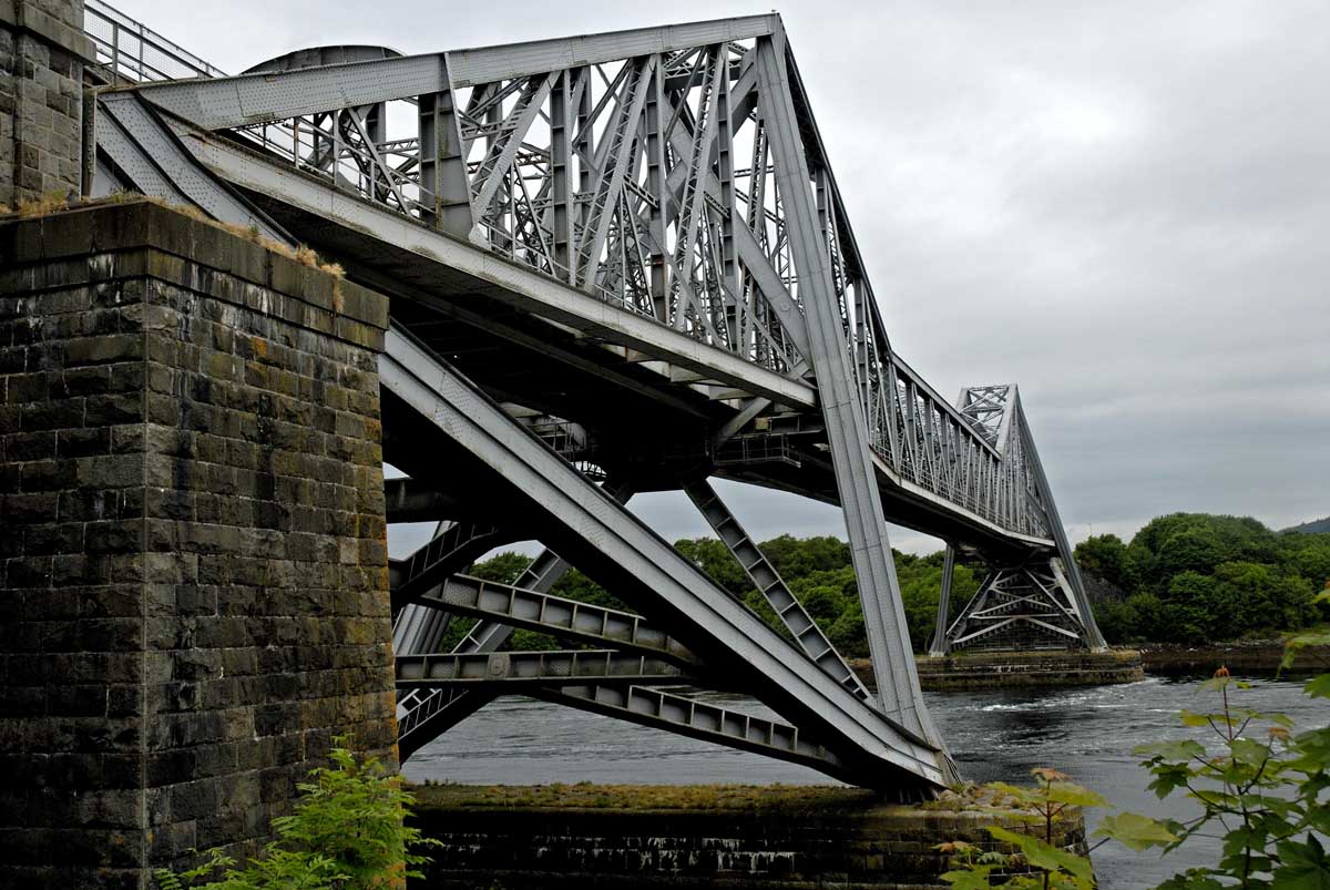
Meandering home from Oban, as one does after having been spontaneous, we noted that the OS road map indicated some ‘falls’ at Connel. There is a blue star printed on the north shore of Loch Etive and a label declaring it to be the Falls of Lora. We decided to investigate. The bridge at Connel is an impressive structure having been built to carry the railway branch line to Ballachulish. Sadly that line no longer exists but at least the bridge remains in fine shape, even if it has succumbed to the all-conquering internal combustion engine. The shame of it! But having a soft spot for all things ‘railway’ a reason to traverse the loch, as if by train, was an added temptation.

Having turned right onto the road to Bonawe, we were in a definite state of perplexity. For waterfalls one usually expects certain geographical features: rocks, water and vertiginousness, steepness approaching the perpendicular. There was a house called ‘Falls View’. Opposite was a field, sloping gently down to the loch. Not a promising location for waterfalls. We drove on for a mile or so but there was nothing to suggest falls of any kind. We returned. ‘Falls View’ was still there. We stopped and looked, and looked again but there was nothing to be seen falling from anywhere. Maybe the cartographers had plonked their star in the wrong place, indeed a misprint. Oh well! Not to worry. But ‘Falls View’ did worry me. What was I missing? There were no waterfalls to be seen on either side of the loch or on either side of the bridge. We re-crossed, rejoined the A85 and headed east. Under the bridge this time and yet, here is an hotel. What is it called? ‘The Falls of Lora Hotel’! And next to it, Falls Crescent. Have we been struck blind, in the manner of Balaam? Is it a joke, a conspiracy? The emperor’s new clothes are just magnificent. There are no blessed falls! At home, an Internet search makes all clear. These are special waterfalls. Sometimes they fall east to west into the Firth of Lorn. At other times they reverse themselves, falling west to east into Loch Etive. At other times they just disappear. How cool is that!

But why? Under the bridge is a rocky lip with an equal depth on either side. Combined with a general narrowness of throat, the effect is to retard the flow of water into and out of the loch and ensures that the tidal range within the loch is considerably less than at sea. At low tide, water pours out of Loch Etive creating the Falls of Lora. At high tide, water pours into Loch Etive creating the Falls of Lora. Slack water, normally referring to calm conditions at high or low tide, unusually occurs at about half tide, thus causing the falls to disappear. The impressiveness of the falls varies according to the phase of the moon, from neap tides with a range of 0.5m that have minimal effect to 4.1m spring tides that produce amazing white-water conditions for surfers, kayakers and other thrill seekers. Loch Etive is 30km long and 1km wide and so has a surface area of 30 million square metres, approximately. That is 30 million cubic meters of water per metre of tidal range. They have twelve and a half hours to get out before it is time for them to return. Therein lies the secret and mystery of the Falls of Lora.

Menu


Loch an Daimh - 26th May 2017

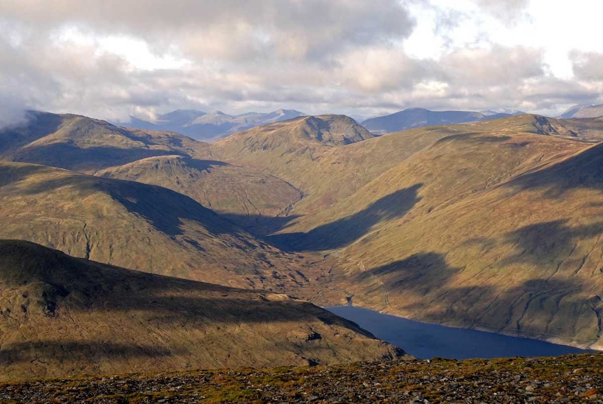
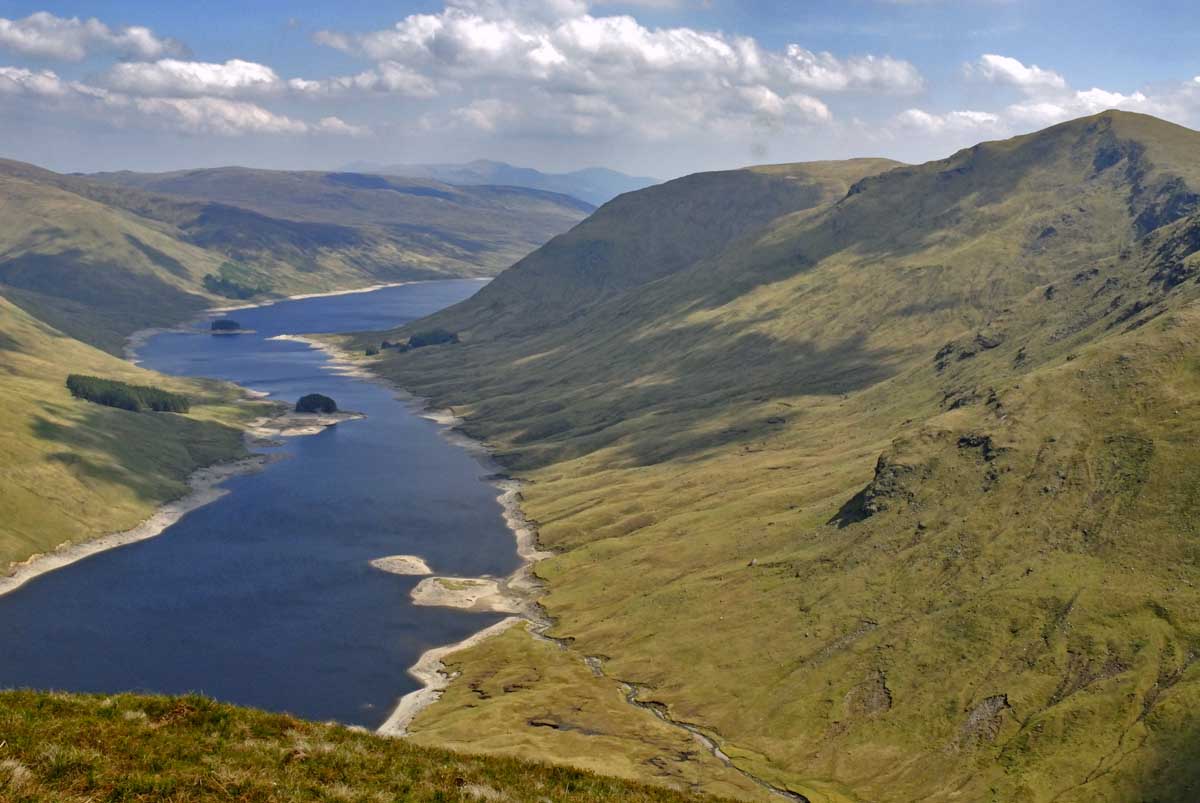
The hottest day of the year so far; that is the prediction of the Met people. Sunshine and blue skies was the forecast and they weren’t wrong. An ideal opportunity, me did think, to bag a couple more Munro’s and there are two in Glen Lyon that have been beckoning for quite a while – Stuchd an Lochain and Meall Buidhe on the Lochs Estate and on either side of the Loch an Daimh reservoir. The question is how to do them. The obvious choice is to tackle them one at a time, returning to the start point in a ‘there and back’ method. Personally, I prefer circular routes that don’t bring me back the way I went. The danger of not doing a circular, having completed the first lump, is to not bother doing the second. ‘It’s hot, I’m tired and oh look! I’m back at the car’ and other lame excuses will be lurking to derail the undetermined. Having recently invested in Cameron McNeish’s book of Munro’s (which, incidentally, is full of typos or inaccuracies, depending on how charitable your nature is) he suggests an entire circumnavigation of the loch. Brilliant idea! That is what I decided upon. He says that it is 20km of walking and with 1070m of ascent. Seems reasonable.

Just before 10am I left the car and headed towards the dam, up the hill and towards a hangar type building. A wee cairn on the left marks the start of a rough but well-trodden track that works its way up the hill to the first top at 887m. From here, on a clear day, there are marvellous views back along Glen Lyon towards Bridge of Balgie. Only it wasn’t a clear day. It was hot, dry and very hazy so one could only but imagine the view. Looking the other way, one’s quarry is in full view – a craggy, pointy lump at the end of a curving ridge forming a corrie that cradles Lochan nan Cat. It’s pronounced stooch an lochan, or stocken locken or chickin lickin or whatever you can cope with. In his narrative, McNeish delights in telling of ‘Mad’ Colin Campbell who took a perverse delight in chasing flocks of goats over the precipice into the lochan below. He it was who built the original Meggernie Castle in 1585. According to the Perthshire Diary (www.perthshirediary.com), his madness came from a blow to the head when a young man. Apparently his first wife managed to keep his madness mostly in check. But when she died he decided that he wanted another one, wife that is. He set off with 100 men, under cover of darkness, to the home of the Countess of Errol, whereupon he raised fire at the gates and by which means she was constrained while his men ‘put violent hands’ upon her and took her away 12 miles. Fortuitously she was rescued by the Earl of Athol and spent the rest of her life pursuing ‘mad Colin – Cailean Gorach’ but to no avail. In the isolated glens of the Highlands the local laird was his own authority, administering justice in his own way. Thirty-five Lochaber men came to a grizzly end at Meggernie for stealing and mudering all because the authorities in Edinburgh chose to pardon them. This was too much and mad Colin became even madder. As long as he remained in the glen he was safe from authorities and enraged Countesses. These Campbells! You never know what dastardly deeds they’ll be up to next.

From the summit I headed west to the next top, Meallan Odhar (815m), before turning southwest down to a difficult bealach, soggy and riven with peat hags. This is to avoid a steep descent into a valley that, according to the OS Landranger map, is full of mixed woodland. It’s not and never has been, at least not in last few hundred years. Had the Evil Lords of the Dark Forest had anything to do with it, the damage would have been obvious and long lasting. The land would have looked as though it had been savaged and clawed at by a huge feline, leaving vast amounts of waste material lying in a tangled and impenetrable mass. No sign of any of this so one has to assume that the OS has got it wrong. An easy climb from the bealach brings one to the summit of a Corbett, Sron a Choire Chnapanaich (837m). It was here that I became aware of some birds with whom I am unfamiliar. Larger than a thrush, they were brownish, paler underneath, a longish bill and had a very clear, loud, monotone call. In flight they had very pointy wings. I saw others during the day and subsequent investigation has led me to believe that they might have been Greenshanks. Apparently they breed in Scotland on high moorland. But they are waders. No wonder I’m confused. As confused as they are. The next challenge was how to get off this Corbett. The only non-steep side was the one I ascended. All the others seemed to disappear into oblivion. One tried to peer over the edge to see what was below but that was futile. The opposite slope was steep and craggy and covered in scree and probably offered a glimpse of what I was about to perchance upon. But McNeish says that it’s doable so do it we will. By heading north from the summit and then round to the west it is possible to find a very steep but grassy rake that leads between the crags down to the burn. As I struggled down, a dozen or so red deer came bounding past as if the entire earth was just dead flat. If they weren’t so nervous they would have stopped and fallen over in helpless laughter at my pathetic staggerings. Maybe I will take up a diet of grass. Does wonders for them!

Lunchtime beckoned and what a fantastic place for it to do so. If it wasn’t for the sheep and the broken remains of fencing, one could be forgiven for believing that this is a most wild place. Hemmed in on three sides and the loch winding its way eastwards on the fourth, it is a wonderfully lonely place. But the fences and the sheep and the occasional passing aircraft are all reminders that nowhere in Scotland is truly wild. But it’s better than Basingstoke High Street! The north side of the loch is less interesting. Having clambered up the steep side, I headed for a top called Meall Cruinn (830m), which is not quite a Corbett. It has a remarkably impressive cairn for such an insignificant lump. But it does afford splendid, distant, views of the Glen and the Ben – Coe and Nevis respectively. There’s the big shepherd of Etive and Bidean nam Bian beyond and over there, the Mamores. In between is the vast wasteland that is Rannoch Moor. Heading in a north-easterly direction across undulating moorland one eventually arrives at the second Munro of the day, Meall Buidhe. It’s not exciting – just a grassy hill with two tops, the northern of the two being the higher. Heading south along the ridge and then down the hill back into the glen, one is rewarded with some fine views along the loch. And then the car appears and the day is over. Tired and footsore, I am certain that there has been more than 1070m of ascent. I checked it later on the OS and I reckon 1470m is closer to the truth. Not that knowing about that extra 400m would have put me off, but all the same, one likes to think that one can trust the published word! I think that 1070m is about right if one does the two Munro’s separately from the dam. He has forgotten the additional tops.

Menu


An Ode to the A83

On this overcrowded, impoverished, island, finding a decent road to simply enjoy is a challenge. Here in the Highlands there are many marvelous roads, most involving single track with passing places, which go nowhere but are stunningly remote and dramatic. But what about an empty road that can be driven fast? Ah, yes, they’re a little harder to find. Nevertheless, I think I may have found one. First of all I must state that I’m not vouching for the quality of its maintenance. It, like many others around here, is cared for by BEAR. White on blue signs proudly declare that fact. Alas, a bear could likely do a better job. A recent trip to Fort William revealed the obvious reality that the Luftwaffe has been using the A82 for nocturnal target practice. I can think of no other reason why such a major arterial road would be so full of craters. The A83 is not exempt. The road surface is decidedly wanting in many places. Nevertheless, and with that caveat, it is still a delightful road to mosey along. It is a well engineered road, generally full-width, with long straights and sweeping curves. There are some exceptions, yet these are completely forgivable and just add to the charm and character of the road. Just to the north of Inveraray, the eighteenth century Aray Bridge takes the traveler across the river to the fore of Inveraray Castle. It’s all part of the architecture and so to remove or rebuild it would be sacrilege. Traffic lights do the job. At Ardrishaig, a single carriageway swing bridge allows boats to exit the Crinan Canal. And at Minard any widening would take the road into front gardens, even front rooms. It is a road to be enjoyed. It is reasonably empty to start with and just gets emptier as you head south. And all the while the glorious views are, well, glorious.

It all starts at a TOTSO junction at Tarbet, on the shores of Loch Lomond. TOTSO? Well, if you are heading from Glasgow to Fort William on the A82 and you don’t, you end up in Campbeltown (cam’belton). Confusingly too, there are many Tarbets and Tarberts. The name comes from Gaelic, An Tairbeart, and refers to an isthmus or land bridge between two larger lumps of land. In this case the waters are the sea loch of Loch Long and the sweet water of Loch Lomond (surface elevation 7.9m). The first community, just two miles in, is Arrochar. It has a very attractive situate at the head of Loch Long and is famous for its Alps, notably The Cobbler and a number of Munro’s. Sadly the whole area has a long and present military connection. Arrochar was home to a torpedo testing station, unarmed specimens being test-fired along the loch for later recovery. I suppose their unarmed state was of some comfort to the local, civilian, maritime community, safe in the knowledge that their craft would simply be sunk and not blown to smithereens. Moving on:

The road now commences its climb up Glen Croe towards the Rest and be Thankful. With modern vehicles this milestone is barely noticeable, other than the car park and burger van. But in days of yore, should you have been a horse or on Shanks’ Pony, no doubt this is exactly what you would have done. What is noticeable is the perpetual road works. Built on the side of The Cobbler, it is a sort of shelf, cut into the mountainside. Alas it is not a particularly stable mountainside – landslips are a common feature, regularly closing the road. Part of the thankfulness to The Lord might have been for getting through unscathed. These days the hillside is covered in protective metalwork, but natural forces cannot really be so constrained.

Heading downhill, Loch Fyne soon comes into view, the longest sea loch and one that stretches south all the way down to the Isle of Bute and its eventual meeting with the Firth of Clyde. At its head, two signs will be seen – Loch Fyne Brewery and Loch Fyne Oysters. What more could a man want? Beer and aphrodisiacs. Well, actually…

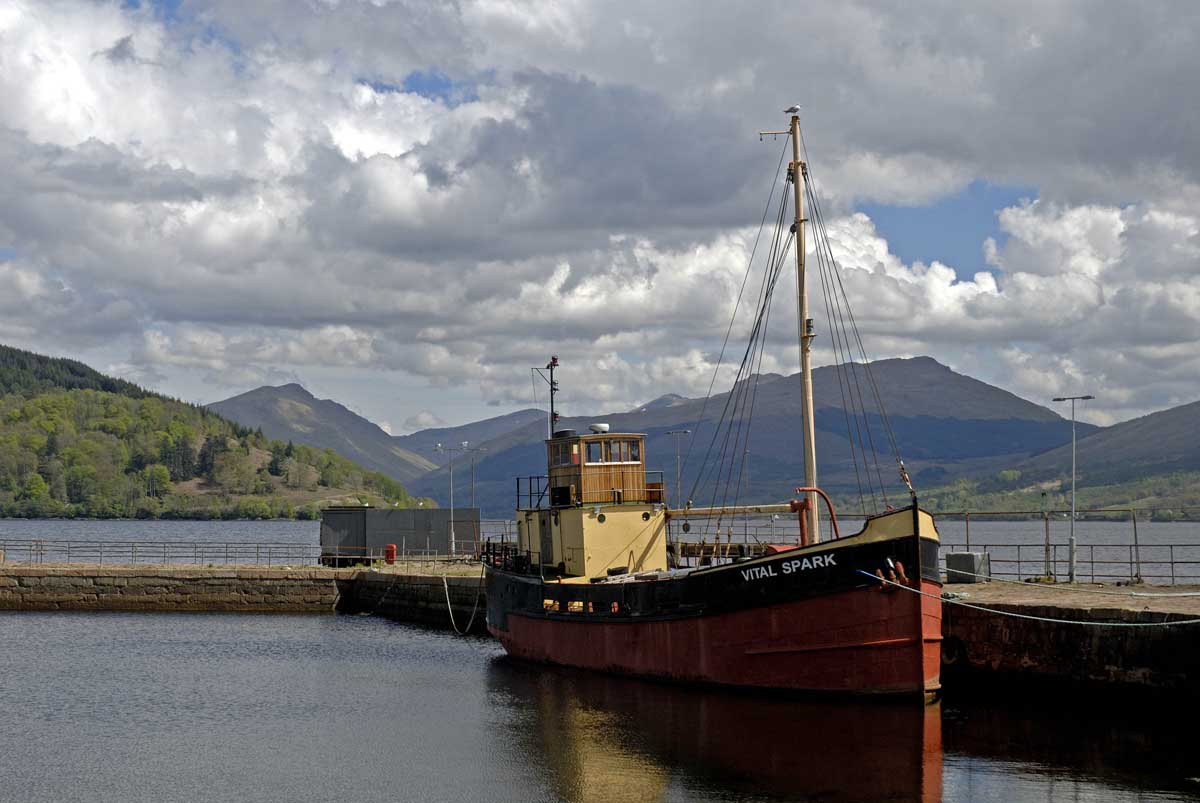
We soon come to Inveraray with its aforementioned twin-arched bridge. It’s a very attractive place, with an array of whitewashed buildings gathered along the water front and around the harbour. The jail, now a museum, is apparently worth a visit. There is church in the middle of the road and, just through an archway at the junction with the A819, fuel. Take note - such places are not common on this road. The parking is all Pay & Display (also the PCs!), but note too that there is a Co-op just to the south of the town which could have a dual purpose. Inveraray proudly declares itself to be the birthplace of Neil Munro. Who he, we wondered? Not Munro of the mountains. He was a Hugh. This one was a journalist and an author aka Hugh Foulis. One wonders if the captain of the Vital Spark, one Para Handy needed to avoid unarmed torpedoes. If you take the A819 north, you will see a great big monument on a hill to his name.

Heading south, the road turns inland for a few miles before rejoining the coast whilst bypassing Furnace. I may be doing it an injustice but it appeared to be little more than a council housing estate. Such snobbery! Suffice it to say that there was no obvious incentive to take a detour. Who knows what gems we might have missed?

Just before the pretty hamlet of Minard, we pass signs for Crarae Gardens. This is a National Trust for Scotland property, described as an ‘exotic splash of wilderness’, ‘a proper Himalayan glen set in the gentle hills of Argyll’. One for another day, methinks.

Eventually we sweep around a headland and head north into Lochgilphead. Ceann Loch Gilb or Kinlochgilp. Take your pick. Anyway, a Tesco and Esso are on the approaches to the town and, if memory serves, I believe this is the last chance to refuel before Campbeltown.

A really worthwhile detour can be taken here to explore the Crinan Canal. You’ll see the eastern end later at Ardrishaig but if you take the Oban road to Cairnbaan and onto the B841, you’ll follow the canal, cross it on a swing bridge, see all the locks and lockkeepers cottages, until you come to Crinan sea-loch. All very pretty and un-Highlandesque. Above Bellanoch, on the road to Tayvallich, is Knapdale Forest and the site of the first Beaver releasing experiment. There is a walk from the loch to a viewpoint which presents a wonderful panorama of the canal, Loch Crinan and its estuary.

Back on the A83, head south, enjoy the drive, enjoy the views across to the Cowal peninsular. And then, as you sweep round a right-hander, there is Tarbert below you, looking charming as it clusters around the East Loch. The desire to stop instantly and take a picture is tempered by the fact that such a course is inadvisable – there is nowhere to pull in and a certain law will demand that there be a vehicle behind at this very point. The road, descending into the town, is noticeably narrow. Park up, bide a wee, have a wander, look at the ferry to Portavadie, and when ready, continue the journey. At the back end of the town, more water is encountered – and you realise that, yes, this is a Tarbert. This is the West Loch and it is only by that tiny piece of land, occupied by the town, that Kintyre dangles in its rather flaccid manner.

For the first time our road trip takes us to the west coast. For those of us who pleasure in CalMac ferry timetables, we finally discover what is at Kennacraig – nothing! A farm by that name and a ghastly concrete structure that serves as a reception for the ferries from Islay, Colonsay and Oban. But then this is ferry central. Along the B8001 on the left is a ferry to Lochranza on Arran, and shortly we come to the ferry for Gigha, a community-owned island.

This side of the peninsular presents a wilder, dramatic visage. This is now the Atlantic, uninterrupted to North America. Islay and Jura are off to the west in hazy outline. Community-owned Gigha looks like a rather uninviting rock of barren-ness. There are some beautiful beaches and the road is broad and spacious, occupied only by the occasional Peter McKerral Transport of Campbeltown lorry. It almost seems to be his virtual private highway. At one point there are some very attractive cottages to the left and where the road swings inland, there is a large car park serving Westport Beach. A lovely sandy beach it is too.

As our destination nears, signs for the innocuously sounding Campbeltown Airport appear. This, in a previous life was RAF Macrihanish. During the cold war it came under US control. Why does an airport in this remote corner of the UK have Scotland’s longest runway, at 3.2 km? Oh, the rumours abound! Officially(!) it was built for the space shuttle to make an emergency landing in Europe, should the need arise. Unofficially, and denied by everyone, it was used by Aurora, the quasi-mythical Mach 8 delta-wing plane (not) developed by the US. In 1994 a Chinook helicopter crashed near here killing all the intelligence chiefs on board. The cause was never satisfactorily explained. Human error? Software error? A sonic boom from Aurora that destabilised it? Shortly after this incident the US handed Macrihanish back to the MoD. Guilty conscience? Move on, nothing doing here. Exits stage left, whistling nonchalantly.

And thus we arrive, 98.3 miles from Tarbet, at the end of the A83 in Campbeltown itself, a town with palm trees (we’re a long way south) some elegant buildings, including a rather smart art-deco picture house, but generally with an air of having been shut down (although I highly recommend McIlchere’s bakery - three sausages, bacon and a fried egg in a roll for three quid). At the head of Campbeltown Loch, there is a harbour, ferry terminal and a waterfront that is workaday but pleasing enough. The ferry terminal these days is used for a thrice-weekly service to Ardrossan. It had been built for a service to the much closer Northern Ireland. That service barely began before it had stopped. Who wants to take a ferry to arguably the most remote mainland town in the UK? And having arrived to be faced with an even longer ferry service to Scotland’s east coast or a 200 mile, 4 hour journey to anywhere populous? The crossings to Troon, Ardrossan and Cairnryan are much more straight-forward and commercially viable. Also worth mentioning is a prominent rock in the loch called Davaar Island - complete with cave and mysterious painting of 'Jesus'. Low tide reveals a causeway for walking out to it. We were there at high tide! We’ll just have to return one day.

The A83 used to continue from here to an anonymous spot a few miles further on but that is now part of the B842. Far more sensible.

Has it been an enjoyable trip along our A83? Very much so. A mountain pass, lochs and glens, an ocean, sandy beaches, pretty towns and villages, islands and ferries, a canal and a fast and empty road. I remember experiencing the A9 between Inverness and Perth in the mid 1980s and being thoroughly impressed. That too was a joyful drive. It is a purpose-built single and dual carriageway road. Back then it was empty and one could floor the accelerator and watch the ever-changing scenery slip past at 80mph (an Austin Metro - it was doing well). The occasional HGV could be dispatched with ease. Speyside became Tayside, Slochd and Drummochter summits were dramatic. These days, well, the scenery hasn’t changed but the ‘killer’ A9 is no longer a joyful experience. It is too busy. Overtaking opportunities are few and far between. Average speed cameras are pretty much irrelevant. HGVs are limited to 50mph and so therefore, by default, is everything else. It’s a frustrating journey. It is currently, and very slowly, being converted to dual carriageway throughout, and, whilst that will reduce such frustration and the journey time, I’m sure that it will also ruin its character. Still, we always have the A83 to Campbeltown.

Menu


The Unprepared - 27th October 2018

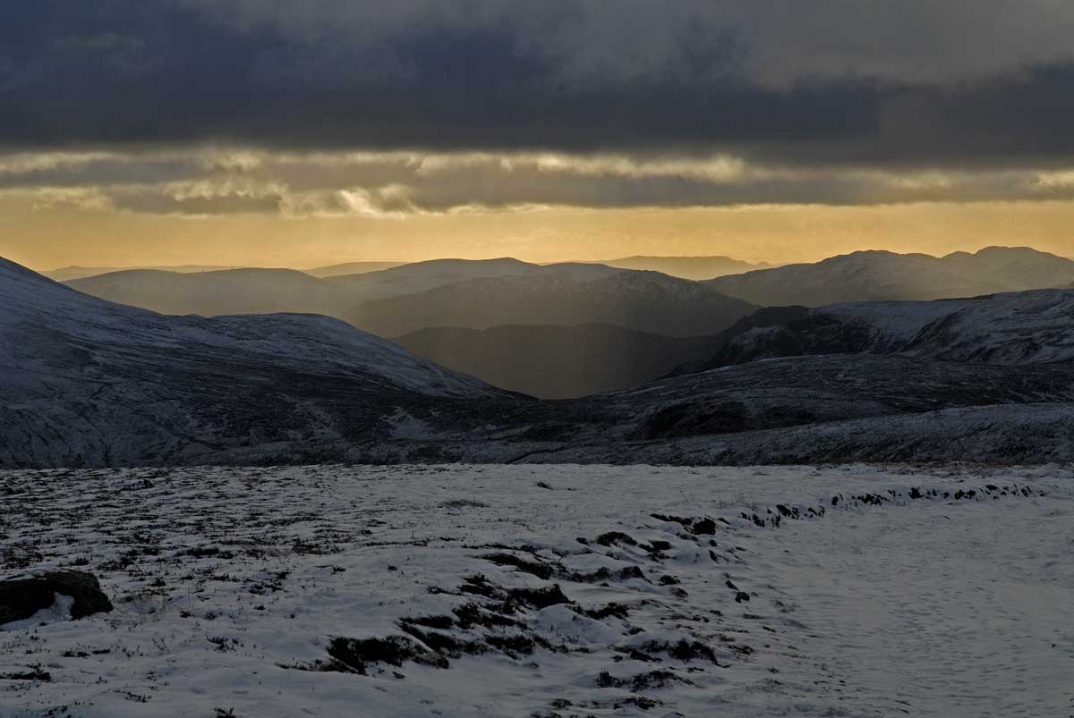
There was a plan. But then it changed and led to disappointment. It was to tackle Creise and Meall a’ Bhuiridh from the Glencoe ski resort. On arrival the two summits were invisible, blanketed in thick and low cloud. That was sad as the surrounding peaks were all very clear. I assured myself that these two would clear and set off down the track towards Blackrock Cottage. From here McNeish advises the walker to head west to contour around the end of the ridge. With all the popularity of Munro-bagging one kind of expects to find evidence of where the hoards have been. Alas, no. With no obvious route I headed west and very soon found myself wading through bog. I looked to my left and my quarry was still enshrouded in gloom. Ahead was Buachaille Etive Mor in glorious sunshine. I lost the will and soon found myself parked at the foot of the Big Shepherd. Both pairs of hills are on the same OS Landranger, so I felt not unprepared. I knew too that there are two Munro summits up there, but not having the book with me and not having read-up beforehand, I didn’t think that this would be a problem. Up I went, conquered the two highest lumps and returned to the vehicle, feeling suitably happy with two more to add to the list – numbers 61 and 62.

On the way up, I encountered deux hommes Francaises, one carrying a tiny day-pack and l’autre entirely unencumbered. He was wearing a puffa jacket, leggings and something akin to trainers on his feet. Unprepared for any eventuality. Conditions were good but cold. Freezing point was around the 700m mark, above which was snow and ice, and we were tackling a north-facing gully where the sun won’t shine until next May. It was decidedly slippery underfoot in many places. Once the ridge had been attained, there was a strong wind which introduced a chill factor of several degrees. In this climate were these two Gallic jokers, dressed as for a post-prandial stroll.

Having gained the bealach, the going becomes easier. It’s a relatively simple walk to the top of Stob Dearg, the main summit and the one that is so dominating of the approaches to Glencoe along the A82. Nevertheless, descending towards me on this easier stretch was a lady of mature years receiving considerable assistance from her gentleman companion. We exchanged greetings and continued on our ways. Sometime later when I returned to the bealach, this old girl was now being assisted by two gentlemen. It seems that they were having considerable difficulty with the very icy section immediately below the ridge. As much as one applauds positivity and the ‘can-do’ attitude one does ponder on whether she was entirely prepared for what awaited her.

At home, I too discovered the follies of unpreparedness. In recording my two Munro’s I discovered to my horror that I had missed the second Munro. Not having planned to deal with the Big Shepherd I hadn’t read-up beforehand. I knew from previous browsing that there were two Munro’s. So I did the two biggest lumps that were marked on the map. Only the big thing in the middle is not a Munro. The little thing on the end is a Munro. The big thing in the middle looks stately and impressive. The little thing on the end looks like, well, a little thing on the end. I had done the big thing in the middle and turned back missing out an official Munro. Arrrr! Who decides these things? And what is a Munro? My understanding of the original definition is any point over 3000 feet above sea level with a minimum prominence of 500 feet (153m). If this holds true then neither the thing in middle (Stob na Doire) nor the thing on the end (Stob na Broige) are Munro’s. The first bealach is between 860 and 870m giving Stob na Doire a minimum prominence of (1011–870) 141m. The second bealach is between 810 and 820m and Stob na Broige stands at 956m. Therefore its prominence is (956–820) 136m. Of the two, Stob na Doire has the greater claim. When checking the first edition of McNeish, one finds that Buachaille Etive Mor had just the one Munro summit. Stob na Broige was ‘promoted’ in 1997. One wonders why and by whom? Either that or the OS map is wrong. And the lesson to self? Be prepared! And don’t let a box-ticking exercise run, or even ruin, the day, because it was a splendid day, after so much wind and rain. Visibility was superb with views down to the head of Loch Etive, The Isles of Lismore and Mull, the bridge at Ballachulish with Moidart beyond, Rannoch Moor and, unmistakably in the distance, Schiehallion.

Menu